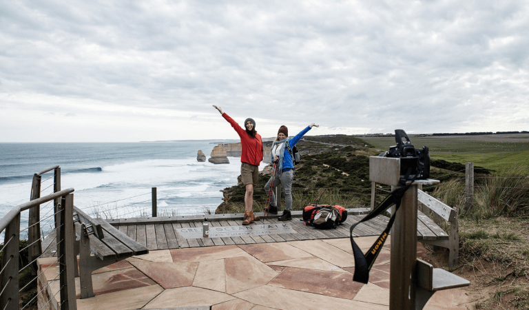
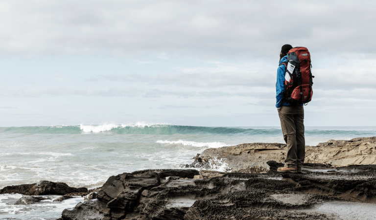
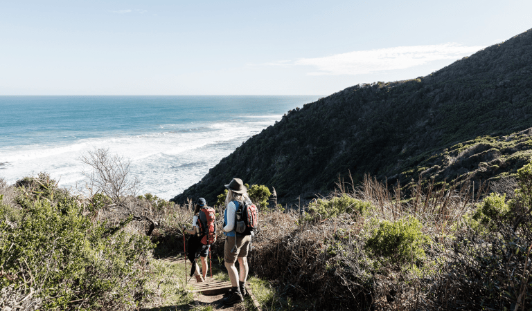
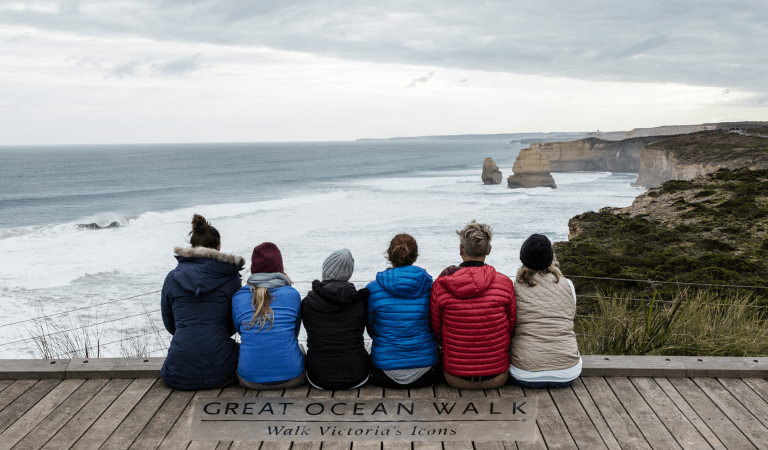
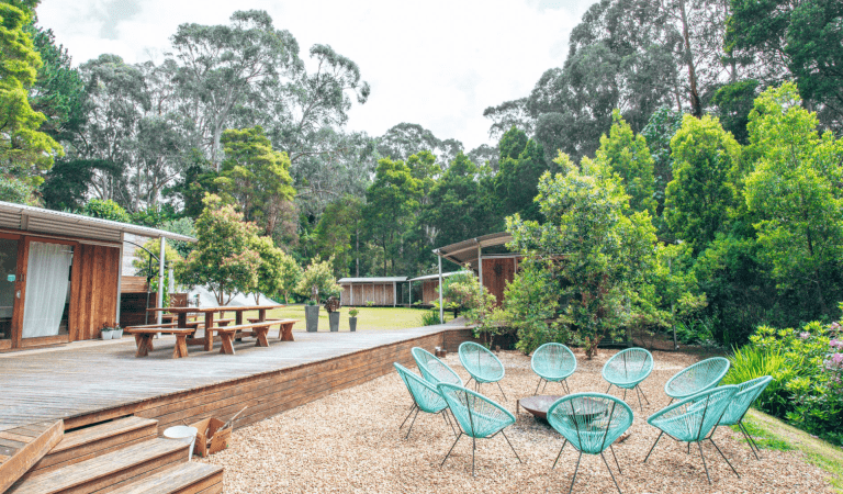
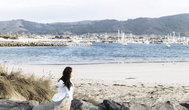
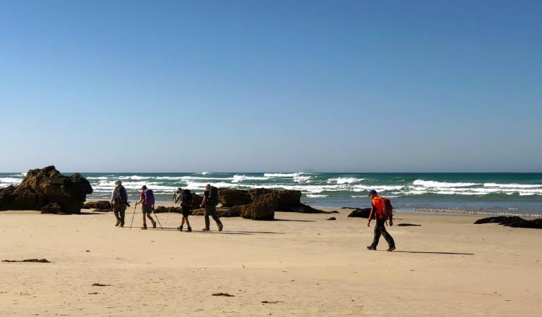
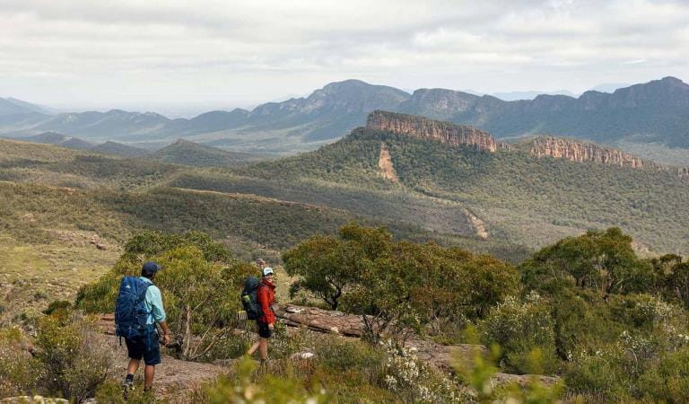
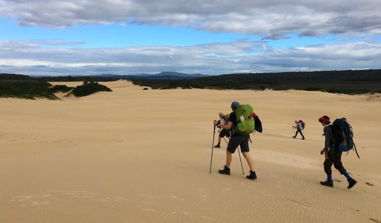
Return again and again and build your own Great Ocean Walk experiences. Several half-day walks explore the tall forests of the 'tamer side' or for the more experienced hiker, the remoter, steep and isolated coves of the 'wild side' in the sections closer to the Twelve Apostles.
Short Walks
Less than 3 hours in length, ranging in difficulty and all are accessible from established visitor car parks.
Lighthouse Cemetery and Lookout Walk – 800m, walk grade easy
The gravel path leads walkers from the carpark out through beard heath to a hilltop lookout. You will be rewarded with views across to the lighthouse, and the ocean. Visit the historic cemetery which bears witness to the realities of lives lost at sea and the harsh isolation of early light station life. Fee applies for Cape Otway Lightstation entry.
![]() Start: Cape Otway Lightstation carpark
Start: Cape Otway Lightstation carpark
![]() End: Cemetery
End: Cemetery
Marengo to Shelly Beach – 4.4kms, walk grade medium
A mixture of rocky foreshore, wind swept hilltop views and tall shady forest. The exposed, and aptly named, Bald Hill traverses on and off the beach through the sheltered forest to picturesque Shelly Beach and up to the picnic area. Take the coastal route at low tide and during calm seas.
![]() Start: Marengo caravan park
Start: Marengo caravan park
![]() End: Shelly Beach picnic area
End: Shelly Beach picnic area
Shelly Beach Walk – 900m loop, walk grade medium
This is one of the best short walks on the Great Ocean Walk. The track will take you through fern gullies, coastal scrub, to Shelly Beach.
![]() Start: Shelly Beach picnic area
Start: Shelly Beach picnic area
![]() End: Shelly Beach picnic area
End: Shelly Beach picnic area
Princetown to the Twelve Apostles – 7.0kms, walk grade medium
The walk begins near the Gellibrand River Bridge. You will traverse cliff-tops and undulating heath-clad dunes as the distinctive rock stacks begin to reveal themselves. Continue past Gibson Steps Beach (which is not accessible at high tide) to end at the iconic Twelve Apostles kiosk and carpark facility.
![]() Start: Princetown Recreation Reserve
Start: Princetown Recreation Reserve
![]() End: Twelve Apostles kiosk and carpark facility
End: Twelve Apostles kiosk and carpark facility
The Gables Lookout – 400m, walk grade easy
This easy return walk travels through a Casuarina tree grove to a spectacular clifftop lookout. Enjoy views over the ocean and the reefs surrounding Moonlight Head. This is one of the highest sea cliffs on mainland Australia. Keep a close eye out for seabirds, or whales from June to September.
![]() Start: The Gable carpark
Start: The Gable carpark
![]() End: The Gable Lookout
End: The Gable Lookout
Wreck Beach – 350m, walk grade medium/hard
This difficult but rewarding walk descends over 350 steps to Wreck Beach. At low tide the walk takes you to the anchors of the Marie Gabrielle and the Fiji – haunting reminders of the treacherous nature of the sea. Make this walk at low tide only and beware of large sea swells.
![]() Start: Wreck Beach Carpark
Start: Wreck Beach Carpark
![]() End: Wreck Beach Carpark
End: Wreck Beach Carpark
Day Walks
Day walks are up to 6 hours in length. All walks start from the main visitor areas and the distance and terrain make these longer walks more challenging and requiring preparation for safety and enjoyment.
Aire River to Johanna Beach Day Visitor area –12.5 km, walk grade medium/hard
This is a long but satisfying walk through diverse terrain to beautiful Johanna Beach. Pass through heathland with spring wildflowers and experience awesome sea views. Watch above for Sea Eagles soaring overhead. Johanna River is an unbridged beach crossing, so carefully assess before wading across following heavy rains.
![]() Start: Aire River Visitor Area (information shelter)
Start: Aire River Visitor Area (information shelter)
![]() End: Johanna Beach Day Visitor Area.
End: Johanna Beach Day Visitor Area.
Cape Otway to Aire River – 10kms, walk grade medium
Explore the lightstation before you set out. The walk to Aire River carves its way through a wind-sculpted landscape of sand dunes, coastal scrubland and calcified cliffs. Along the way Station Beach (and Rainbow Falls) is side trip well worth taking. Rainbow Falls is spring-fed water trickling down through algae to the rock platform below. The Falls are a 3-kilometre return journey from where you first enter Station Beach at Decision Point 8. When you return from Rainbow Falls, exit Station Beach at either Decision Point 8 where you first entered the beach, or further towards Aire River at Decision Point 8B, which will take you back onto the main GOW route. Continue along to the Aire escarpment lookout, before descending down to the beautiful Aire River Campground.
![]() Start: Cape Otway Carpark
Start: Cape Otway Carpark
![]() End: Aire River Visitor Area
End: Aire River Visitor Area
More Great Ocean Walk Experiences
Licensed tour operators
Hike for 1–3 nights
Hike for 4–6 nights
Hike the whole 8 days
How to get there
Short and Day Walks
When you're there
Explore the region
Off-walk accommodation
Towns and Villages
Eat and Drink
Visitor Information Centres
Need to know
Short and Day Walks
Plan and Prepare
Walkers must move in an east-west direction. The walk was designed and built to be walked in an east-west direction. This will maximise views and generally provides the best gradient to reduce impacts from walkers and congestion of the walk and its facilities.
If you have not undertaken a long-distance walk before, or for a reasonable period of time, it is recommended you undertake some walk training. You will be walking all day, for up to 8 days. There are steep staircases and track sections that go up and down again. Sections of the track can be wet, muddy and slippery. Prepare well to enjoy yourself and get the most from your experience.
Beach Walking and High Tides
Planning ahead using tide times may save yourself a lot of inconvenience, disappointment and delay during your walk. Many beaches are exposed to high tides, large waves and hidden dangers like ocean currents, rips and reefs.
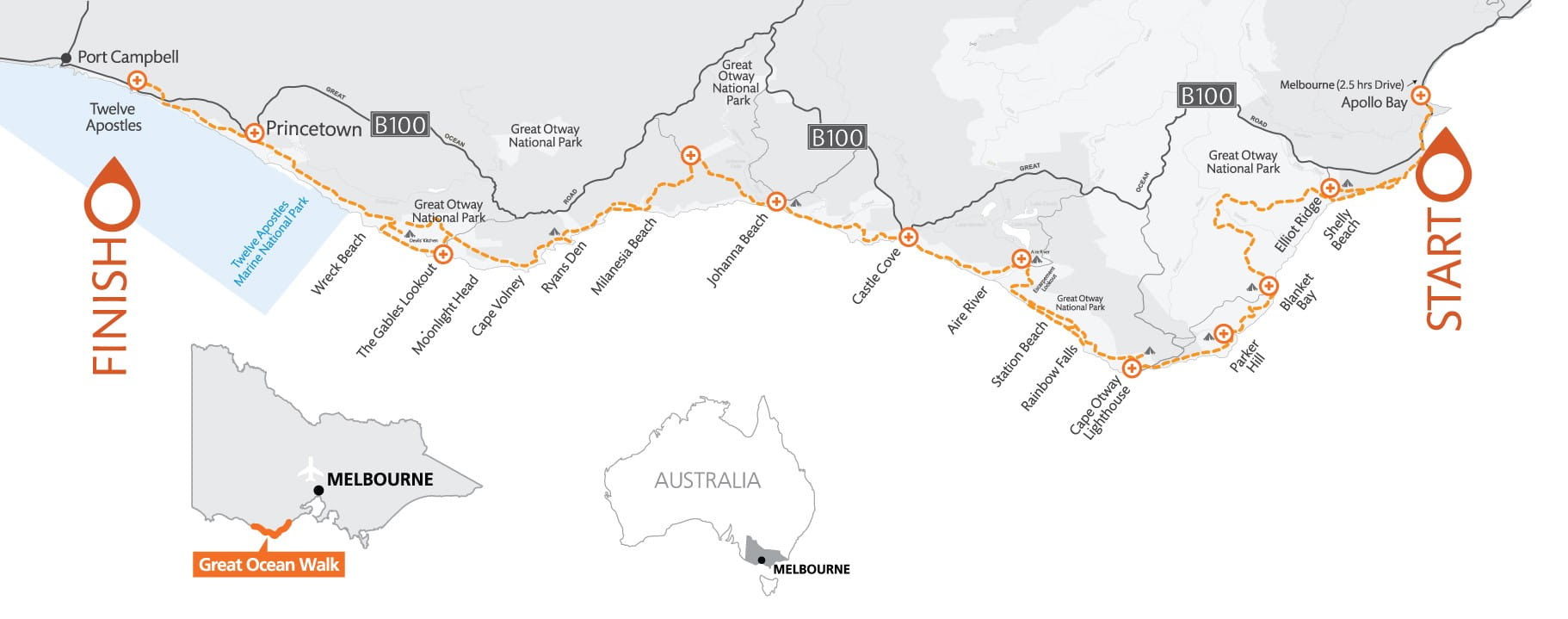
In some sections of the Great Ocean Walk, alternate beach walking sections are available. Beach access points are marked on the Great Ocean Walk Map and on the walk. Emergency markers state your ‘on and off’ access points and yellow flags mark track arrival and departure points from the beach.
The Great Ocean Walk in-land routes offer shelter from strong sun, bad weather, high tides and waves. It is vital that you consider tides, ocean swell and weather before taking an alternate route. Conditions may change quickly. You should only attempt to walk along the coastline during low tide and calm sea conditions.
The Great Ocean Walk route is clearly marked with signs and has inland options in all areas except Storm Point, West of Bald Hill, Johanna Beach and Milanesia Beach first section. Beach walking is required in the Milanesia (300m) and Johanna (2km) sections of the walk. These beaches and generally passable under normal tide and calm weather conditions. Only proceed with these sections when it is safe to do so.
Wreck Beach (at Moonlight Head) should only be walked at low tide. Walking under the cliff line can become dangerous or impassable at high tide or with large ocean swell. Ensure you are aware of Port Campbell tide times prior to attempting this section of the walk.
Refer to Port Campbell tide times (subtract 4 minutes from Portland tide times) for west of Moonlight Head to the Twelve Apostles, including Wreck Beach.
Refer to Apollo Bay tide times (subtract 28 minutes from Port Phillip Heads times) for east of Moonlight Head.
River crossings
No pedestrian bridge exists for Elliot, Parker Inlet, Johanna and Milanesia River crossings. Heavy rain, rough seas and high tides may make crossings at Elliot, Parker, Johanna and Milanesia Rivers challenging or impossible. Hikers may need to wade across rivers after high rainfall.
It is your responsibility to carefully assess depth and flow before you cross. Be prepared to wait until you consider it safe to cross.
Change of Conditions
Nature being nature, sometimes conditions can change at short notice. It’s a good idea to check this page ahead of your visit for any updates.
-
Notices Affecting Multiple Sites
Gibson Steps Beach Closure
Gibson Steps beach access has been temporarily closed due to recent geological movement.Geological assessments and remediation works have commenced. The site will reopen once the hazard has been removed and visitor safety is assured.Great Otway National park sites closed due to major flood damage
Severe thunderstorms and flash flooding on 16 January 2026 has caused significant damage across parts of the eastern Great Otway National Park.For public safety, the following areas are closed until further notice while assessments and clean-up works are undertaken:Closures included but are not limited to :Erskine falls is limited to the top viewing platform. Access to the base of the falls and along the river track is closed.Roads & TracksWye RdWye TrackCurtis TrackGodfrey TrackJamieson Track
Walking tracks
St George
Phantom falls
Lemonade ck
Kalimna
Henderson
Sheoak FallsSheoak picnic ground walking Nature LoopCumberland
Cumberland Garvey Link
Kalimna Garvey LinkCora LynnErskine Falls Walking TrackWon WondahMany roads, tracks and visitor facilities are impacted by debris, flooding and unstable conditions.The Great Ocean Road has been impacted,Always follow safety signage and directions from response crews, and do not enter any closed areas.Thank you for your patience and understanding as works are undertaken to make these popular areas safe to visit again.
Great Ocean Walk destination car parking at the Twelve Apostles visitor center during summer & Peak Visitation periods
During the busy peak visitation period at the Twelve Apostles precinct (from summer through to early autumn including school holidays, public holidays, long weekends & busy peak visitation weekends concluding after Chinese New Year / Easter), due to the sheer volume of visitors onsite, a traffic management program is in place to maximize public safety & ensure visitor experience. If you are planning to park your vehicle at the Twelve Apostles before walking the Great Ocean Walk (or sections of it including section 8) during this period, please communicate this information to onsite traffic control staff at the entrance & they will do their best to accommodate your vehicle in the main carpark. This will avoid your car remaining in the overflow carpark area which needs to be cleared and locked each night. Similarly, if you arrive at the Twelve Apostles to park your car at a time when traffic control are not onsite, or setting up, please park your vehicle in the main carpark area. Your assistance is greatly appreciated!Twelve Apostles Precinct- Change of Conditions Update Notice as of 20.10.2025
General Public InformationDue to ongoing construction works at the Twelve Apostles Visitor Centre, significant changes to access and parking arrangements will be in effect from Friday, 19th September 2025. All visitors are asked to plan ahead and be patient when travelling to the site during this busy period. High visitation is expected in-line with School and Public HolidaysKey changes and reminders for visitors include:- Temporary
Changes to Parking:
Construction works have resulted in temporary parking areas and altered traffic flow. Expect reduced speed limits, changed parking arrangements, and traffic management on-site. Please see attached map. - Car
Parking:
In the event of full parking capacity, visitors are encouraged to seek alternative destinations such as Port Campbell township or Bay of Islands, and encouraged to return later in the day. - Pedestrian
Safety:
Use designated walkways and pedestrian crossings only. Do not climb fences or viewing barriers. - Environmental
Care:
Protect this unique landscape by staying on paths, respecting barriers, and taking your rubbish with you. - Bushfire
Safety:
Stay informed by visiting emergency.vic.gov.au, downloading the VicEmergency app, or calling the VicEmergency Hotline on 1800 226 226.
For more information, contact Parks Victoria on 13 1963 or visit parks.vic.gov.au
Licensed Tour Operators (LTOs)
IMPORTANT – Operational and Access UpdateFrom Friday, 19th September 2025, the following updates apply to all Licensed Tour Operators visiting the Twelve Apostles:New Access & Parking Procedures:- Coach/Bus/Coaster
Access:
All LTO vehicles must access the temporary parking area via Booringa Road and the new entry/exit road. Directional signage will be in place. Please see attached map. - Temporary
Parking Area:
Use designated bays only. This area has been established during current construction works. - Drop-Off
Instructions:
- All
vehicles (with or without trailers) must drop passengers
at the front of the Visitor Centre.
- Pick-ups
are not permitted at the drop-off zone.
- Drivers
must proceed immediately to the designated parking area
after drop-off.
- Provide
passengers with clear directions and walking instructions before they
disembark.
Traffic Management:- Follow
Traffic Controller Instructions at all times when management is
in place.
- Be
prepared for redirection to alternative parking areas based on
capacity.
- Observe
on-site signage directing different vehicle sizes to specific parking
bays.
Operational Reminders:- Permit
Display: Ensure your LTO permit is clearly displayed on
your vehicle at all times.
- Passenger
Safety: Remind passengers to use designated walkways and not to climb
fences or barriers.
- Journey
Planning: Allow extra time, travel safely, and prepare staff for
delays due to high visitation and traffic coordination.
Stay Informed:- Further
updates and staging plans are available at the Development Victoria
website:
www.development.vic.gov.au/projects/twelve-apostles?page=resources
Thank you for your cooperation in maintaining a safe and enjoyable experience for all visitors while works are underway. Your support is essential in protecting the Twelve Apostles and surrounding areas.Attachments: LTO Map Updated 17.10.25 Conditions A3 (98KB)
- Temporary
Changes to Parking:
-
Loch Ard Gorge (Port Campbell National Park)
Loch Ard Gorge Beach Access Steps Closed
Loch Ard Gorge beach access steps are currently closed due to geological instability. The site will remain closed until remediation works are completed to remove the hazards and ensure visitor safety.


