


The rolling hills of Heyfield, Licola and Dargo give little indication of the spectacular gorges that dissect the south-east corner of the Alpine National Park. Moroka and Bryces Gorge hide impressive waterfalls, while Mount Howitt, the Wonnangatta Valley and Tali Karng make for scenic settings to cross-country skiing, hiking, horse riding, deer hunting and four-wheel driving adventures.
Lake Tali Karng hides deep in the mountains and is the only natural lake within the Victorian Alps. Held behind a rock barrier created thousands of years ago, the underground stream it feeds emerges at the infant Wellington River.
The Wellington River has 13 numbered campsites just north of Licola on the Tamboritha Road. Sites offer facilities such as toilets, fire places and picnic tables. You can enjoy camping under the shady trees with easy access to the river. The geology of the surrounding area is spectacular and makes for a memorable camping experience.
The spectacular Wonnagatta Valley lies among forbidding mountains accessible to adventurous walkers, four-wheel drive enthusiasts, horse riders and deer hunters. Follow the epic Wonnangatta Drive and discover the ruins of an old homestead near the confluence of the Conglomerate Creek and Wonnangatta River, cattlemen’s huts on the high alpine plains and Grants Historic Area which includes the large grassy Talbotville camping area, just beyond the boundaries of the Alpine National Park.
Bryce’s Gorge is arguably one of Victoria’s most spectacular natural features. Not too far from Guys Hut, there is little warning of its existence until the open plains and snowgum woodlands plunge abruptly into a deep abyss. Follow the Bryce’s Gorge Circuit Walk to see Pieman and Conglomerate Falls tumble over the rim of the gorge into a chasm below.
Climb to the top of Mount Howitt, breaking at Vallejo Garntner Hut. Heritage listed for its architectural values, the hut was built in 1970.
Things To Do
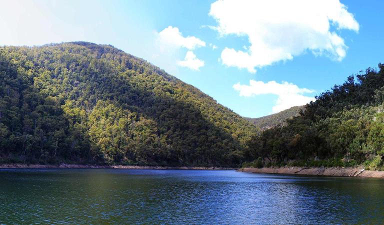
Tali Karng

Wonnangatta Icon Drive
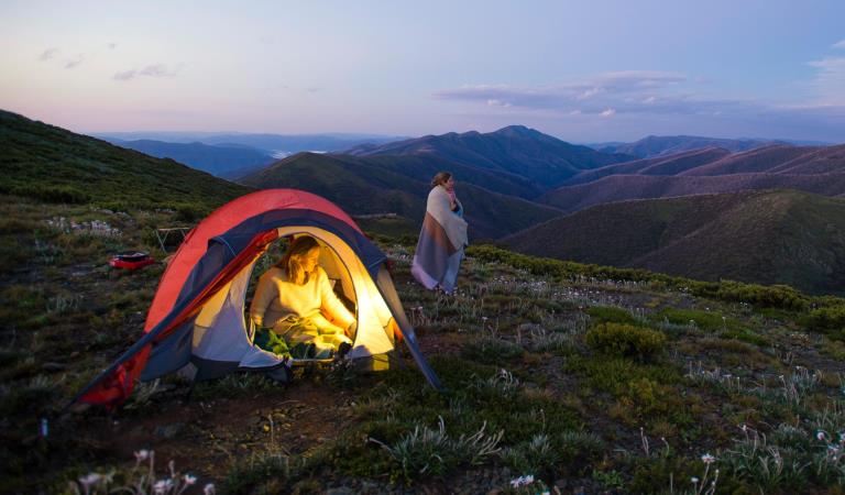
Dispersed camping in Alpine National Park
How to get there
Heyfield, Licola and Dargo
When you're there
Download the Parks Victoria visitor guide to get the most out of your Heyfield, Licola and Dargo visit.
The rolling hills and remote valley's hide some of the most beautiful landscapes in the state. The arduous Wonnangatta Drive meanders through the isolated landscapes of Wonnangatta Valley and brings to life the wonderful history of the region - from the ruins of old gold mining towns and cattleman's huts on the high plains to the unsolved murder-mystery of Wonnagatta Station.
Tali Karng sits comfortably among the mountains at the head of the Wellington River, while Bryce's and Moroka Gorge hide spectacular waterfalls, such as Conglomerate and Pieman Falls. The peaks of Mount Howitt, Mount Reynard and Snowy Bluff look out over the forbidden landscapes and remote wilderness areas of the Alpine National Park.
Other activities to note include:
- Wonnangatta Valley - interesting murder mystery lingers over the abandoned cattle station
- Grant Historic Area and the abandoned town of Talbotville now an amazing campground
- The beautiful Dargo and Howitt sub alpine landscapes
- Vehicle based camping along the Wellington River, Horseyard Flat and Thomastown
- The several historic cattleman's huts such as Howitt, Guys, Moroka, Kellys
- Vallejo Garntner Hut - heritage listed for its architectural values and surrounded by some of the most spectacular views in the Australian Alps.
- Bicentennial National Trail - iconic horse riding trail that crosses the Southern Alps and runs from Cooktown, Queensland to Healesville in Victoria 5,330km.
- The incredible hiking trails around Tali Karng, Bryces Gorge, Moroka Falls and Mount Howitt
- Epic four wheel drive experiences such as the Blue Rag Range and Billy Goat Bluff Tracks
When to go
The best time to explore the Alpine National Park on foot is between November and April. The mild summer temperatures found in the high altitudes of the Alpine National Park are the perfect retreat from its lower-lying counterparts and make for perfect hiking conditions. While the occasional sunny day can see daytime temperatures rise above 30°C, the nights are still cool.
Head towards the Mount Howitt and the Snowy Plains in summer when masses of wildflowers carpet the slopes – from Billy Buttons to Snow and Swamp Paper Daisies.
Need to know
Heyfield, Licola and Dargo
Accessibility
Visiting a park can be more of a challenge for people with disabilities, however in Victoria there are a wide range of facilities to help people of all abilities enjoy our wonderful parks around the state.
Assistance dogs are welcome in Parks Victoria parks and reserves. Entry requirements apply for parks and reserves that are usually dog prohibited, such as national parks.
Change of Conditions
Nature being nature, sometimes conditions can change at short notice. It’s a good idea to check this page ahead of your visit for any updates.
-
Talbotville Historic Township Camping Area (Grant Historic Area)
McMillans Road Fire Recovery Roading Works
Fire recovery road maintenance and drainage repair works are being undertaken at multiple locations along McMillans Road between Talbotville Campground and the Grant Historic Area. Works include grading, drainage reinstatement, culvert repair and replacement, scour repair and associated traffic management activities.Visitors may experience temporary delays, changed traffic conditions, intermittent stop/go traffic management and short-duration road closures while works are underway. Access to Talbotville Campground, the Crooked River area and surrounding visitor destinations will remain available wherever practicable, however delays should be expected.Visitors are requested to follow all traffic-management directions, obey signage and allow additional travel time when visiting the area.Expected duration: 24 September 2026 to 30 November 2026, subject to weather conditions, contractor scheduling and site conditions. -
Alpine National Park
Cobberas, Ingeegoodbee and Macfarlane Flat Track closures.
The following tracks have been significantly damaged by storms and floods and are currently closed to motor vehicles to ensure public safety and environmental protection:- Cobberas Track
- Macfarlane Flat Track
- Ingeegoodbee Track
The tracks are likely to remain closed to motor vehicles until detailed site assessments have been completed. It is difficult to predict when planning approvals will be obtained to allow for repairs to commence.
Before visiting, visitors should check the Parks Victoria website for the latest information about their destination.Attachments: FAQs for Cobberas ingeegoodbee and mcfarlane tks (128KB)
Alpine National Park: road and track closures
These roads and tracks are closed due to current weather conditions at alpine elevations:
- Dargo High Plains Road
- Blue Rag Range Track
- Basalt North Track
- Twins Track
- Twins Jeep Track
- Mount Murray Track North
- Gunns Track
These tracks will remain closed until seasonal closure openings on 29 October 2026.In the interest of public safety, Victoria Police, Department of Energy Environment and Climate Action (DEECA) and Parks Victoria closed these high elevation alpine roads and tracks in State Forest and the Alpine National Park.Ground shooting operations targeting deer
Control operations (ground shooting) targeting deer are undertaken in this area. The Park will remain open to visitors during these operations.For more information about Parks Victoria deer control to protect biodiversity, please visit: https://www.parks.vic.gov.au/get-into-nature/conservation-and-science/conserving-our-parks/feral-animals/deer -
Beveridge Station Camping Area (Alpine National Park, UNKNOWN)
Change of Condition Alpine NP – Road & Track Closures:
Dargo High Plains Road, Blue Rag Range Track, Basalt North Track, Twins Track, Twins Jeep Track, Mount Murray Track North and Gunns Track.Due to current weather conditions at alpine elevations and in the interest of public safety Victoria Police, Department of Energy Environment and Climate Action (DEECA) and Parks Victoria will be closing the above-mentioned high elevation alpine roads and tracks in State Forest and the Alpine NP. These tracks will now remain closed until seasonal closure openings on the 29th of October 2026. -
Pinnacles Lookout Day Visitor Area (Pinnacle Ck - East Branch Natural Catchment Area, Alpine National Park)
Fire Recovery Works
The Pinnacles Lookout Day Visitor area is currently closed to visitors for repair works to reinstate assets damaged during the 2025-26 Wonnangatta Dargo Complex fires. Works are expected to be finished by the 1st of November 2026 and access will be reinstated. -
Notices Affecting Multiple Parks
Planned aerial shooting operations targeting deer
The following Parks will have some areas closed while aerial shooting operations are undertaken.Alpine National Park - Bogong High Plains, Dinner Plain, Mt FeathertopMt Buffalo National Park16-20 November & 23-27 November 20261-5 and 8-12 February 2027Popular visitor sites, walking trails and campgrounds are generally excluded from treatment areas and will remain open to visitors.More information and maps with details on access restrictions be posted here in the coming weeks.Ground shooting operations targeting deer
Control operations (ground shooting) targeting deer are undertaken in this area. The Park will remain open to visitors during operations.